Austin, Texas · City Walks
The best
dog walksin Austin.
Waterfront loops, shaded greenbelts, and room to roam—chosen for the dogs who walk them and the humans holding the leash.
7,656
walks mapped in Texas
7,660
miles walked
59
Texas cities with walkers
HappyPupper walkers across Texas · all-time totals, November 2026
Map your own Austin walks. Free on iPhone & Android.
Choose the right adventure
One city.
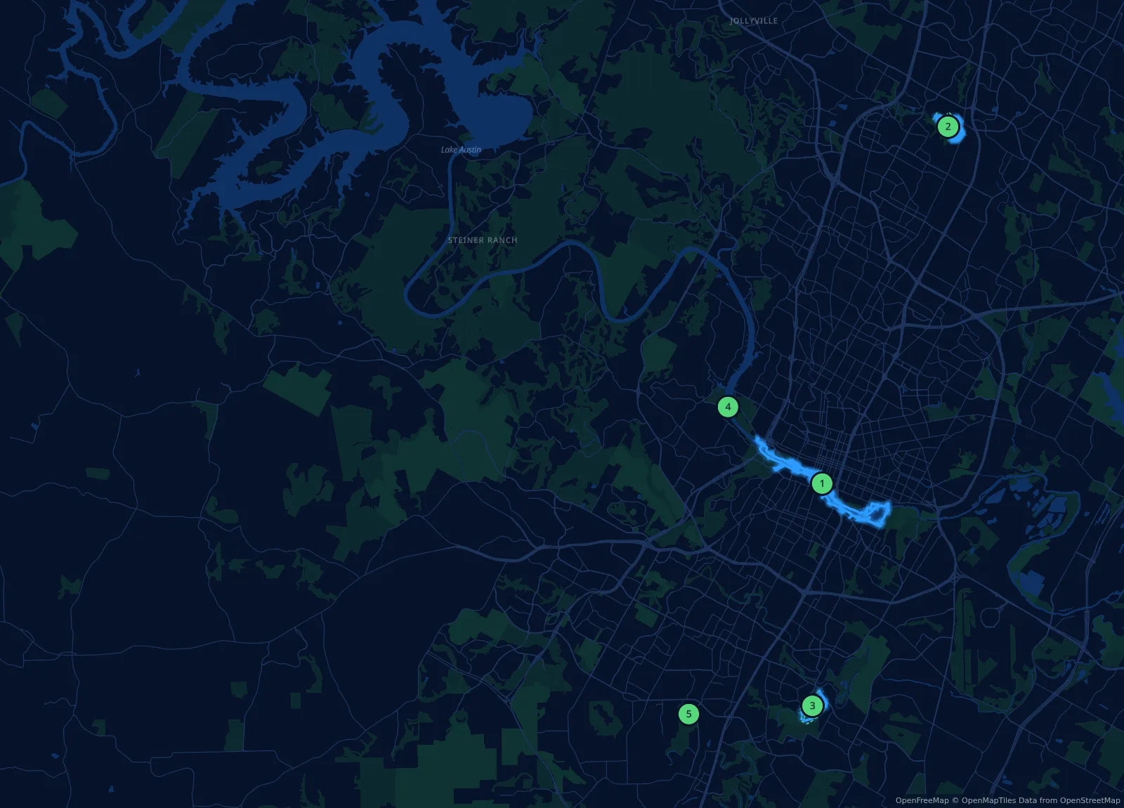
Five very good walks.
Austin rewards an early start. The best routes move from skyline views to limestone creek beds and oak-shaded trails in a matter of miles. This guide focuses on places where the walk itself is the point—not just a patch of grass with a parking lot.
Austin City Code requires dogs to be leashed in public areas except inside designated off-leash areas—and you leash up again walking to and from them. Four of these five walks include one of the city’s official off-leash areas, outlined on each map. Bring water, watch the heat, and follow posted park rules.
Before the leash comes off
Conditions change. Check Austin’s current park closures before you go. Around Lady Bird Lake, keep dogs out of warm or stagnant water, anywhere you see scum or algae, and for three days after rain—and rinse them off after any water contact.
Best skyline
Butler Trail
Most trail
Walnut Creek
Best quiet miles
Onion Creek
Best short roam
Red Bud Isle
Pick your pace
Five walks worth
clipping in for.
Distances below are flexible suggestions, not fixed courses. Let the weather, your dog, and the trail decide when to turn around. Dashed green lines on the maps mark official off-leash boundaries.
Central Austin
Waterfront
01
Ann and Roy Butler Hike-and-Bike Trail
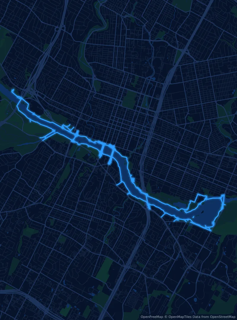
Austin’s classic city walk: water, skyline, bridges, and a steady stream of dogs. Choose a short out-and-back or connect bridges for a longer loop.
Go early. The trail is calmer and cooler before the city fully wakes up. Vic Mathias Shores (formerly Auditorium Shores) has a 3.3-acre off-leash area; everywhere else on the trail, dogs stay leashed. Some boardwalk sections are closed for construction into early 2027, so check closures first.
North Austin
Trail variety
02
Walnut Creek Metropolitan Park
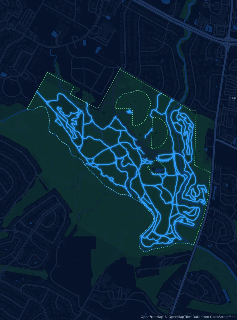
A choose-your-own-adventure network of shared, uneven trails with far more texture than a neighborhood loop—about ten miles of mapped trail inside the off-leash area alone. A strong pick for energetic dogs and curious noses.
Match the trail to the dog. Start with a short loop and save the deeper trail network for cooler days and confident paws. Trails are shared with mountain bikers, so keep recall sharp.
South Austin
Open space
03
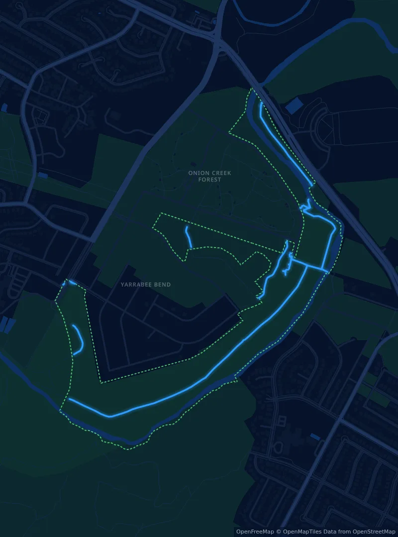
Onion Creek Metropolitan Park & Greenbelt
Wide skies, a quieter pace, and a mix of groomed and nature trails. The north section of the metro park has a one-mile decomposed-granite loop; the adjacent greenbelt holds the off-leash area and nature trails.
Bring your own shade. Open space is the appeal, but it also means more sun. Morning and late-day walks are the kinder choice.
West Austin
Short roam
04
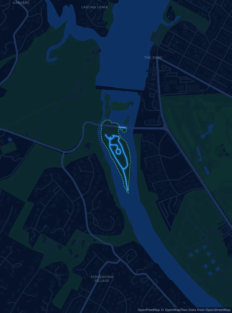
Red Bud Isle
A compact off-leash island with just over half a mile of trail. It is more meander than mileage—ideal when your dog needs room to sniff, not a training run.
Check the water first. The city has found toxic blue-green algae at Red Bud Isle repeatedly since 2019. Keep dogs out of warm or stagnant water and anywhere you see scum, and rinse them off after any water contact.
South Austin
Nature day
05
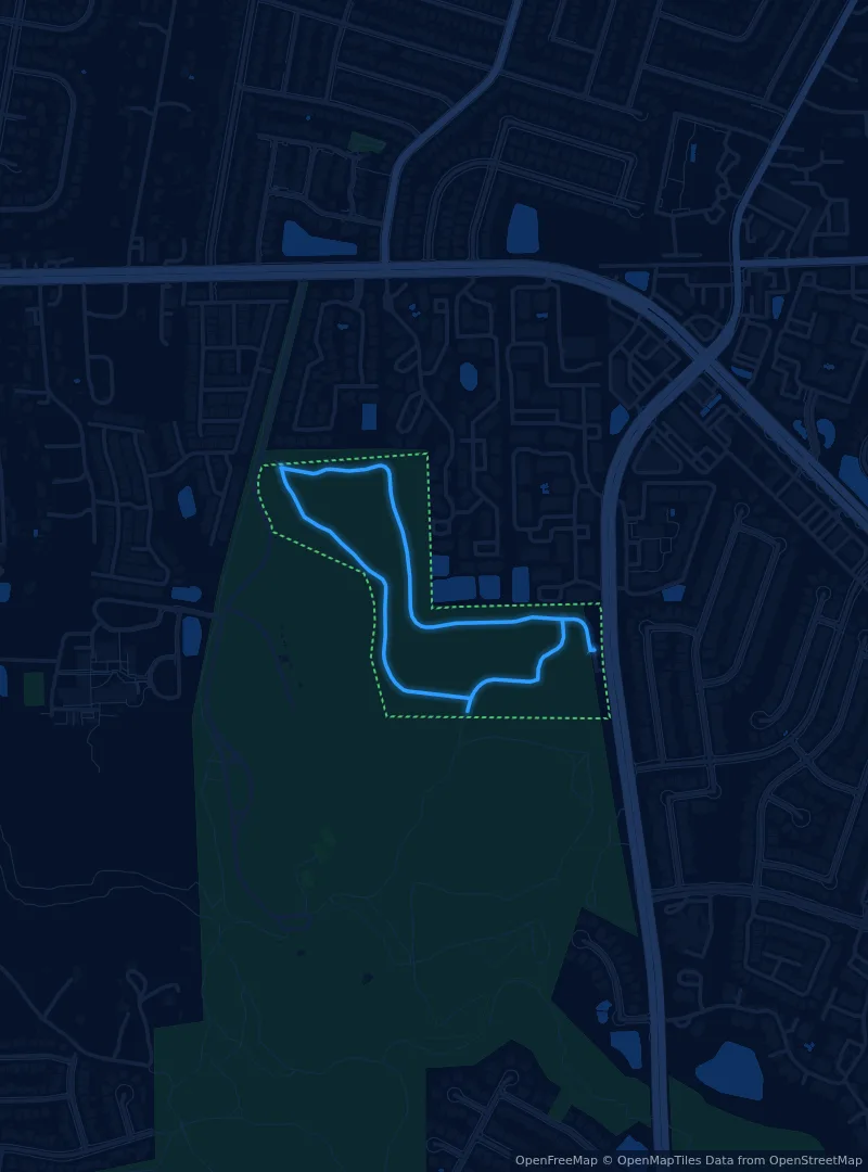
Mary Moore Searight Metropolitan Park
A broad South Austin park with space to stretch the day out. Its off-leash trail suits dogs who prefer a nature walk to a crowded downtown circuit.
Watch the signs. The off-leash area is only part of this much larger park. Clip back in when you leave its marked boundary—the dashed line on the map.
Plan with current information
Official Austin resources
Park rules, closures, and water conditions can change after publication. These City of Austin sources are the final word before you head out. Off-leash boundaries: City of Austin Parks and Recreation. Trail maps: © OpenStreetMap contributors.